Our GIS Services
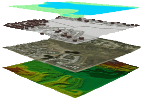
Spatial Spaces provides a vast range of Geographic Information System (GIS) products and services for the clients of public and private sector. Spatial Spaces can assist in many territories of GIS like the areas of system design and implementation, applications development, system integration, and custom programming.
- Digitizing tax parcel maps- Contour extraction
- Geo-coding, attributing and linking databases to generated maps
- Vectorization (Vector map production from all maps or satellite images.)
- Image processing
- Feature extraction
- Ortho-rectification of Satellite Images
- DEM/DTM generation
- Geo-referencing and projection of the digital map information
- Geo-referencing, coding and clipping
- Map Analysis
- Data Capture and Conversion)
- Utility mapping AM/FM mapping
- Project Cadastral/Parcel Mapping